Loher%20Stone%20Fort
Southwest Ireland | County Kerry
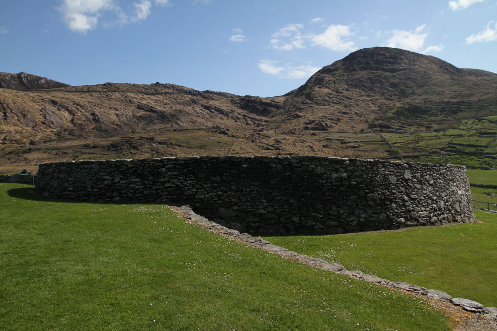
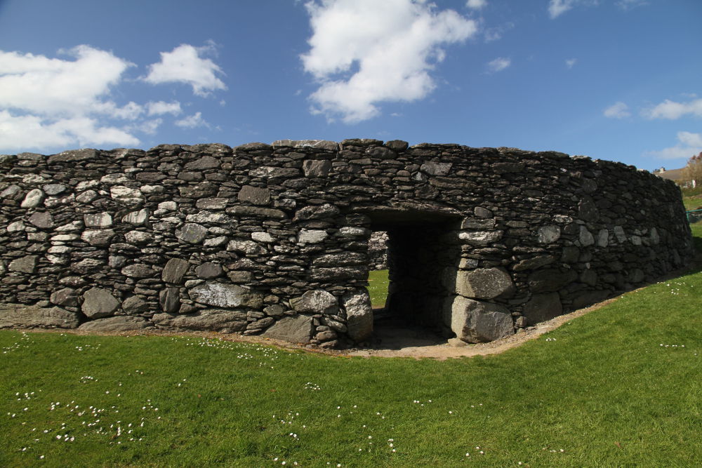
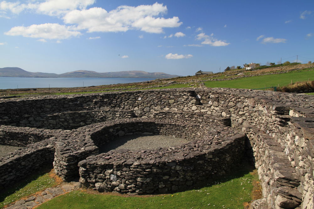
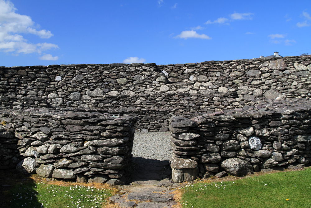
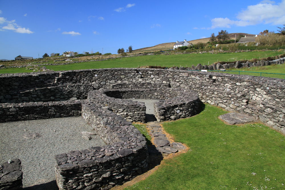
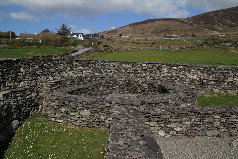
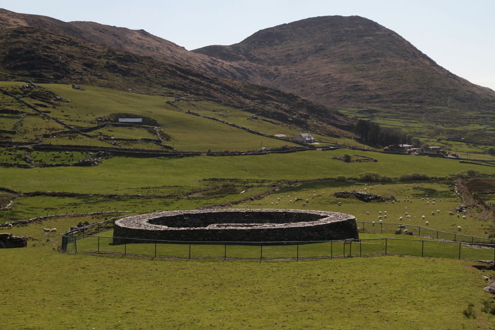
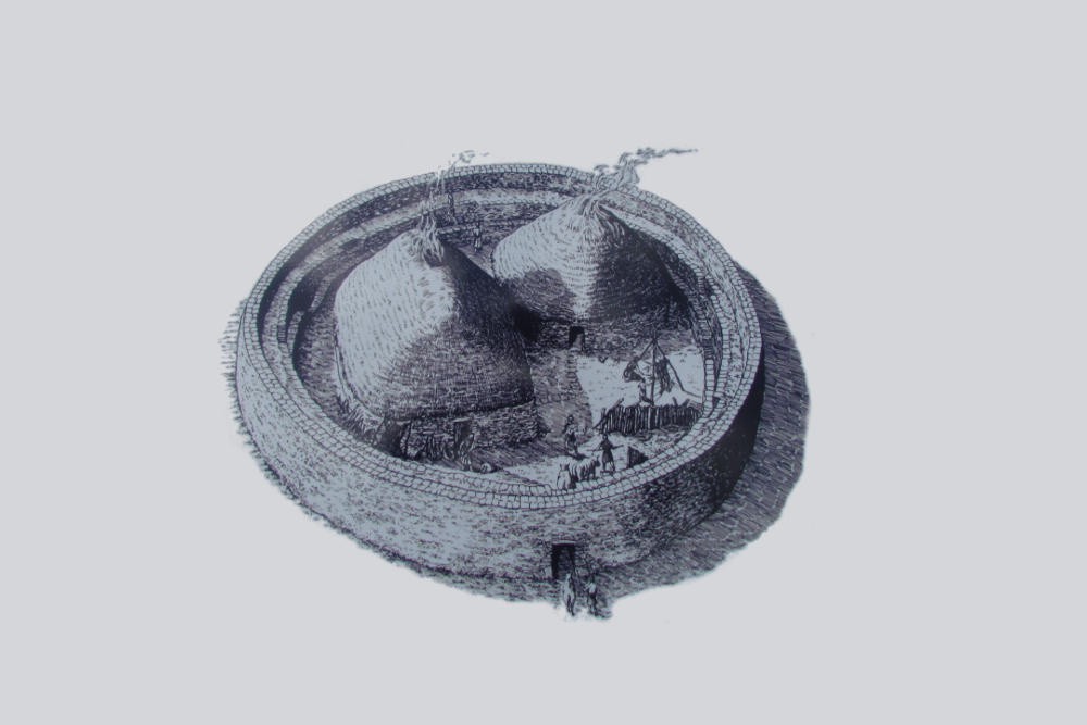
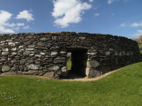
Loher Stone Fort is situated on the foothills of Beenarourke and Farraniaragh Mountain, overlooking Ballinskelligs Bay, midway between towns of Caherdaniel and Waterville, on the Iveragh Peninsula in County Kerry (visible on the "Ring of Kerry" scenic coastal road). This drystone walled ring fort, which was really a defensive farmstead of local chieftain, was erected around the 9th century AD. Enclosure has about 20 m (65.6ft) in diameter, its walls are up to 3 m (20 ft) high and up to 4 m (13 ft) thick with the lintelled entrance from the south-east. Inner wall contains defensive terrace with stairs system leading to the top of the fort which also is defensive platform. There are remainings of two drystone buildings inside the enclosure: one rectangular and one circular (the older one), presumably houses or mayby one was residential and the other was farm building where animals were kept. The rectangular house has suterrain (an underground passage, which now is closed) which may have been used as refuge during attack, but also as cold storage for food. There is also a covered drain, leading from the hut's doorway towards the fort's entrance.
- OPENING HOURS AND TICKETS :
- Freely accessible
- CAR PARK :
- Yes
Photos from Loher%20Stone%20Fort