The Cliffs of Moher
West Ireland | County Clare
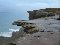
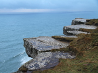
Cliffs of Moher are Ireland's greatest natural attraction visited by about a million tourists a year. The Cliffs rise to 214m (700 feet) at the highest point and range for 8km (5 miles) over the Atlantic Ocean on the western seaboard of Co. Clare. The name "Cliffs of Moher" derives from an ancient fort "Mothar", which was located in the place where today stands Hag's Head - a signal tower built during the Napoleonic Wars. Cliffs were formed about 320 million years ago, during the Upper Carboniferous period, when the area was much warmer and was located at the mouth of a large river. The river towed down bringing mud and sand with it, eventually dumping it all over this area where it settled and eventually formed the rock layers you see today. The Cliffs of Moher is a Special Protected Arera (SPA) under the EU Birds Directive 1979 and is home to Ireland's largest mainland seabird nesting colony (Puffins, Guillemots, Razorbills, Fulmars, Kittiwakes, Peregrine Falcons and Choughs). Strolling along the cliff you can come across a herd of wild goats, and staring at the sea you can see dolphins and seals. If you are lucky then you can see basking shark, humpback or minke whale. In 1835, Cornelius O 'Brien founded the tower, which to this day, serves as a viewing point for tourists. On a clear day, from the roof top of O'Brien's Tower you can see the Aran Islands, Galway Bay, the Maum Turk Mountains in Connemara and Loop Head on the South. Opened in 2007, eco-friendly, grass roofed, set into the hillside Visitor Centre offers self guided tours with short movies and an exhibition about Ocean, Rock Nature and Man. Cliffs of Moher Geopark is part of the UNESCO supported Global Geoparks Network and was established to promote and share the story of this region's outstanding geology and landscape.
Photos from The Cliffs of Moher


