Mount Errigal
Northwest Ireland | County Donegal
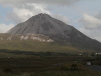
Mount Errigal is 751 meters high and is the highest mountain in County Donegal. Its glowing quartzite, cone-shaped peak dominates the landscape and the rest of Derryveagh Mountains. Is also the part of mountain chain, called locally the "Seven Sisters".
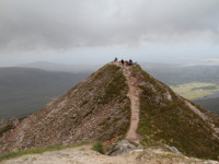
Climbing on Errigal is not technically difficult, but it requires good physical condition and be prepared for the heavily eroded and boggy terrain during the fist part of hiking. The most popular, easy visible track leads from the carpark beside the road R251, which is located just 2 km before village of Dunlewey. No special equipment is needed to climb the mountain, but caution is advised. Reaching the summit gives a sense of achievement and rewards with stunning view of surrounding area including Poisoned Glen, the lakes of Dunlewy and Nacung and other peaks of Derryveagh Mountains. In good weather conditions you will get extended views of County Donegal, its coast and islands.
- CAR PARK GPS COORDINATES :
- 55°01'30.0"N
- 8°05'23.5"W
Photos from Mount Errigal


